

View lesson
 8 min
8 minIntroduction to Geocaging in UAS
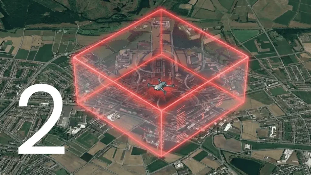

Concept of Geocaging in the U-space Context
Geocaging is a containment concept used in unmanned aircraft systems (UAS) to ensure that an aircraft operates strictly within an approved three-dimensional operational volume. Within the context of U-space, as defined by EUROCAE ED-270, geocaging supports the fundamental objective of U-space services: enabling safe, secure, and efficient integration of UAS into the airspace, particularly in environments where multiple airspace users coexist.
Unlike basic geofencing, which often focuses on preventing entry into restricted areas, geocaging is primarily concerned with keeping the UAS inside a predefined volume that has been assessed, approved, and coordinated through U-space services. This volume is typically defined during mission planning and is consistent with airspace constraints, operational authorizations, and traffic management considerations.
The Role of International Standards: ED-270
While every manufacturer could invent their own way of containment, the industry relies on the EUROCAE ED-270 standard to ensure a common level of safety16. Published in 2020, ED-270 establishes the Minimum Operational Performance Standards (MOPS) for the Geocaging function.
ED-270 is important because it doesn’t just say “keep the drone in a box”; it defines how reliable that box must be. The standard introduces three grades of functionality (Low, Medium, and High) depending on the risk of the operation.
- Low Grade: designed for low-risk missions. It provides Caution Alerts (to warn the pilot a boundary is close) and Contingency Warnings (when the boundary is crossed).
- Medium Grade: includes everything in the Low Grade but adds a higher level of reliability. It is built to ensure the drone leaves its safety volume less than once every 10,000 flight hours.
- High Grade: the most secure level, requiring two independent channels of control. This means that even if the main autopilot fails completely, a second, separate system is there to stop the drone before it leaves the safety buffer.
Safety Role of Geocaging in U-space Operations
Ground Risk Considerations
One of the core safety objectives in both U-space and broader UAS risk management is the reduction of risk to people and property on the ground. Geocaging contributes to this objective by ensuring that the UAS remains within areas that have been assessed as acceptable for the intended operation.
By enforcing a strict operational volume, geocaging limits the spatial extent of potential failures. If a malfunction occurs, the aircraft is less likely to drift into populated or sensitive areas outside the approved zone. This containment principle is consistent with safety methodologies such as SORA and aligns with ED-270’s emphasis on predictable and constrained UAS behavior within shared airspace.
Air Risk and Airspace Integration
ED-270 places strong emphasis on airspace awareness, coordination, and separation. Geocaging supports these goals by reducing the likelihood of unintended airspace infringements, particularly into controlled or high-traffic airspace.
Because U-space services rely on accurate knowledge of where UAS are expected to operate, deviations from approved volumes can undermine strategic deconfliction and traffic information services. Geocaging helps maintain consistency between the planned operation and the actual flight, thereby supporting the overall integrity of the U-space system.
In this way, geocaging is not only a safety feature for a single aircraft, but also a contributor to system-level safety and trust within U-space.
Relationship Between Geocaging and U-space Services
Within the ED-270 framework, geocaging interacts indirectly with several U-space services:
- Flight Authorization: The approved operational volume provided by the U-space service can be implemented onboard as a geocage.
- Airspace Constraints Information: Dynamic restrictions, when updated and properly managed, may lead to updates of the geocaged volume.
- Traffic Information and Deconfliction: Predictable containment improves the reliability of strategic and tactical deconfliction mechanisms.
It is important to emphasize that ED-270 assumes a cooperative environment where operators, UAS, and service providers exchange information. Geocaging enhances this cooperation by ensuring that the aircraft behavior remains aligned with the shared operational picture.
Airspace segregation: the bridge to integration
One of the most powerful applications of Geocaging is enabling Airspace Segregation. In aviation, segregation means keeping different types of traffic away from each other to prevent collisions.
Why Segregation Matters
Currently, the sky is a busy place. Integrating large, autonomous drones into the same space as Boeing 737s or police helicopters is a significant challenge. Until “Detect and Avoid” (DAA) technologies are fully mature and certified, the safest way to fly complex UAS missions is to keep them in “segregated” airspace—volumes of air that other aircraft are not allowed to enter.
Geocaging as the Enforcer
Geocaging is the technical tool that makes airspace segregation possible. By defining a rigid cage, an operator can guarantee to aviation authorities that their drone will stay within a specific corridor.
- Population Protection: geocaging allows us to keep drones over low-population areas (like rivers or industrial zones) and prevents them from drifting over crowds or schools.
- Air Traffic Management: it ensures the drone stays in its assigned “lane” and does not wander into the flight paths of manned aircraft.
Compliance with SORA: In the Specific Operation Risk Analysis (SORA) framework, Geocaging is a primary tool used to address Step 9: Adjacent Area/Airspace Considerations. It provides the technical assurance that the drone will not become a hazard to the areas adjacent to the mission zone
Technical and Operational Considerations
Geocaging typically relies on onboard positioning systems, such as GNSS combined with inertial sensors, to determine whether the UAS remains within its approved volume. While ED-270 does not prescribe technical architectures, it does assume that systems contributing to U-space safety objectives are reliable, monitored, and appropriately managed.
From an operational perspective, geocaging must be:
- Correctly configured before flight
- Consistent with the authorized mission parameters
- Understood by the operator as a support mechanism, not a replacement for responsibility
Operators remain accountable for compliance with airspace rules and U-space procedures, even when geocaging is in use.
