

View lesson
 8 min
8 minAdvanced system integration and future challenges
The paradigm of integrated safety
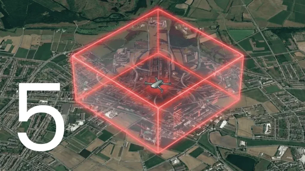
In contemporary aeronautical engineering, safety features like geofencing and geocaging are no longer viewed as secondary “add-ons.” Instead, they are fundamental components of the Guidance, Navigation, and Control (GNC) loops. For professional-grade unmanned systems, especially those operating in complex environments or under the Specific Category (SORA), the integration of these systems must be deep, deterministic, and highly reliable.
Advanced integration ensures that the flight control system is not just reacting to a boundary breach but is actively calculating the vehicle’s state to prevent that breach from ever occurring. This requires a sophisticated synergy between hardware redundancy, software logic, and multi-sensor fusion.
Logic-based configuration and determinism
The cornerstone of a high-performance flight control system is its ability to allow engineers to define complex behaviors through a logic-based configuration environment. Unlike consumer-grade systems with rigid parameters, professional systems utilize a “block-logic” or “parameter-based” approach.
The role of state machines in containment
Within a professional flight controller, geofencing is implemented as part of a comprehensive State Machine. This allows the system to transition between different “Phases of Flight” based on logical triggers:
- Warning zones: a logical condition where the aircraft enters a buffer zone, triggering a telemetry alert or a speed reduction to increase reaction time.
- Hard boundaries (Geocaging): a critical trigger that forces the system into a “Fail-Safe” phase. Because the logic is user-defined, this phase can be tailored to the specific mission, whether it is an immediate landing, a return to a safe “home” coordinate, or the deployment of a ballistic recovery system (parachute).
Hardware redundancy: the foundation of reliability
For missions where a “fly-away” is not an option, such as operations over populated areas or near critical infrastructure, the hardware hosting the geofencing logic must be failure-tolerant.
Redundant architectures
Leading-edge flight control units utilize redundancy systems. This architecture consists of three independent processing cores and a fourth “arbiter” or voting unit.
- Voting logic: each core independently calculates the aircraft’s position relative to the geocage. The arbiter compares these results.
- Dissimilarity and isolation: if one processing core suffers a hardware fault or a memory error, the remaining cores maintain control. The geocaging function remains operational because the “Safety Core” is isolated from the primary mission tasks.
- High-integrity execution: this redundancy is what allows a system to meet high Design Assurance Levels (DAL), making it suitable for integration into aircraft aiming for formal type certification.
Multi-sensor fusion for positioning integrity
A geofence is only as reliable as the navigation data feeding it. Professional systems do not rely solely on a single GNSS receiver. Instead, they employ an advanced Extended Kalman Filter (EKF) to fuse data from multiple sources.
- GNSS availability and integrity: professional systems utilize high-end GNSS receivers capable of tracking multiple signals simultaneously. This high satellite visibility is critical for maintaining a low Horizontal Protection Level (HPL), ensuring the system knows exactly where the aircraft is relative to the geocage at all times, even in challenging RF environments.
- Inertial navigation systems (INS): high-quality IMUs (Inertial Measurement Units) allow the system to maintain a position estimate even during short-term GNSS outages. This “Dead Reckoning” capability is vital for geocaging; if the signal is lost near a boundary, the aircraft can still use its internal “map” to steer back to a safe zone.
- Differential positioning (RTK/PPK): for urban environments where every meter counts, the integration of Real-Time Kinematic positioning provides the centimeter-level accuracy required to fly safely within narrow geocaged corridors.
Real-time connectivity and dynamic geofencing
The future of UAS operations lies in Dynamic Airspace Management. Static geofences are being replaced by dynamic volumes that can be updated in real-time via high-speed datalinks (LTE/5G or Satellite).
Cloud-integrated flight control
By connecting the flight control system to a secure cloud infrastructure, operators can receive live airspace updates. If a “Temporary Flight Restriction” (TFR) is issued while the aircraft is mid-air, the ground station can push the new coordinates directly to the autopilot’s logic blocks. The system then automatically recalculates its path to ensure it remains within the newly defined authorized volume.
Certification standards: DO-178C and DO-254
To operate in the same airspace as manned aviation, UAS avionics must be developed under rigorous standards.
- DO-178C (Software): this standard ensures that the software governing the geofencing logic is developed with a documented, traceable, and tested process. It eliminates the “hidden bugs” that often plague uncertified systems.
- DO-254 (Hardware): similarly, the hardware must be designed to withstand environmental stresses and electronic failures. When geocaging is implemented within a DO-178C compliant framework, it provides the “High Integrity” required by aviation authorities to prove that the aircraft will never leave its designated volume.
Future challenges: u-space and 4d trajectories
As we look toward the 2030s, the integration of UAS into U-Space (or UTM – Unmanned Traffic Management) presents a new frontier of challenges.
Strategic vs. tactical containment
- Strategic geofencing: this is the pre-flight planning of routes and volumes.
- Tactical geofencing: this involves real-time “Detect and Avoid” (DAA) integration. In the future, the geofence will not be a static box but a “moving bubble” (a 4D trajectory) that protects the aircraft from other cooperative and non-cooperative traffic.
Swarm coordination and collaborative geocaging
The next step in integration is the ability for multiple aircraft to share geofencing data. If one aircraft in a swarm detects a restricted zone, it can propagate that information to the rest of the fleet via inter-vehicle links, allowing for collective avoidance. This requires extremely low-latency communication and decentralized processing within the flight control ecosystem.
Conclusion
The evolution of geofencing and geocaging is moving from simple “boundary checking” to a holistic, high-integrity safety ecosystem. By combining redundant hardware, deterministic software logic, and advanced sensor fusion, we are building the foundation for the next generation of Urban Air Mobility. The flight control system is the brain of the aircraft; for it to be truly professional, it must be capable of managing its own containment with the same rigor as a human pilot.
