Investors Euronext | ALUAV | € 27.00

GNSS signals reach the aircraft with extremely low power, so they can be blocked by terrain and urban canyons, overwhelmed by low-cost jammers or silently replaced by spoofed signals that feed a false position into the autopilot. For safety-critical UAS, eVTOL and defense missions, depending on a single satellite source is an unacceptable single point of failure. That is why Embention designs its Veronte components with dissimilar redundancy: the flight control computer fuses inertial, vision and radio-frequency sources so the aircraft keeps a reliable estimate of its position, velocity and attitude, and completes its mission even when GNSS is degraded, denied or untrustworthy.

Terminal Guidance

Point and Track

Point and Track

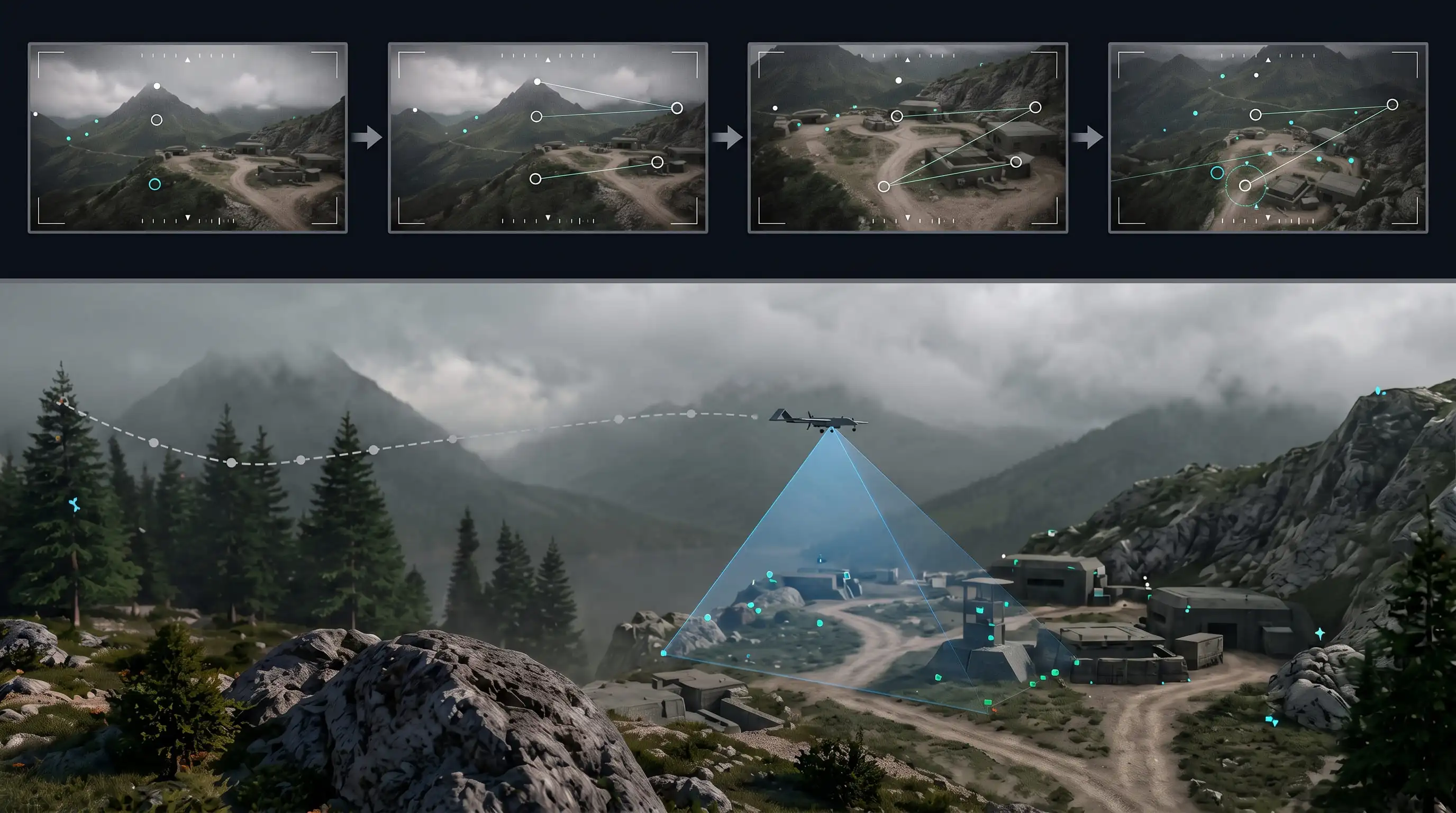
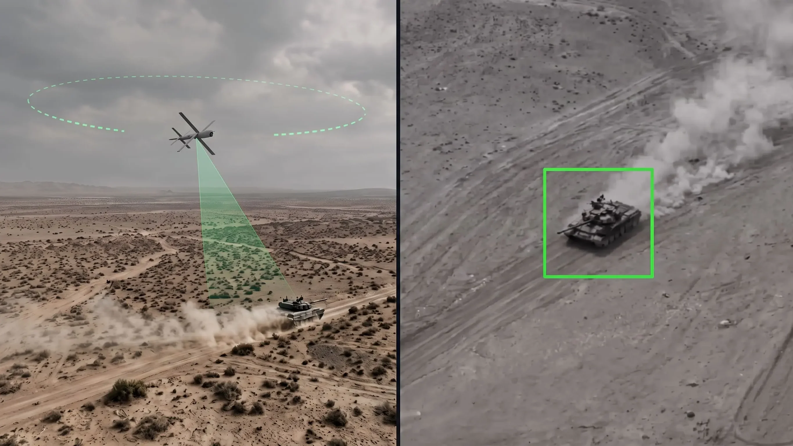
Point and Track locks onto a designated point, feature, or dynamic object in the live camera feed and continuously maintains line-of-sight tracking during flight maneuvers. Correlation algorithms, optical centroid tracking, and deep-learning object detection maintain target lock despite rapid viewpoint shifts, scale changes, background clutter, and partial occlusions.

Tracking deviations feed directly into gimbal stabilization servos and autopilot flight guidance loops. This enables autonomous line-of-sight following, orbit patterns, and persistent surveillance without depending on the target's GPS coordinates or external communication links.
Autonomous Target Engagement

Autonomous Target Engagement

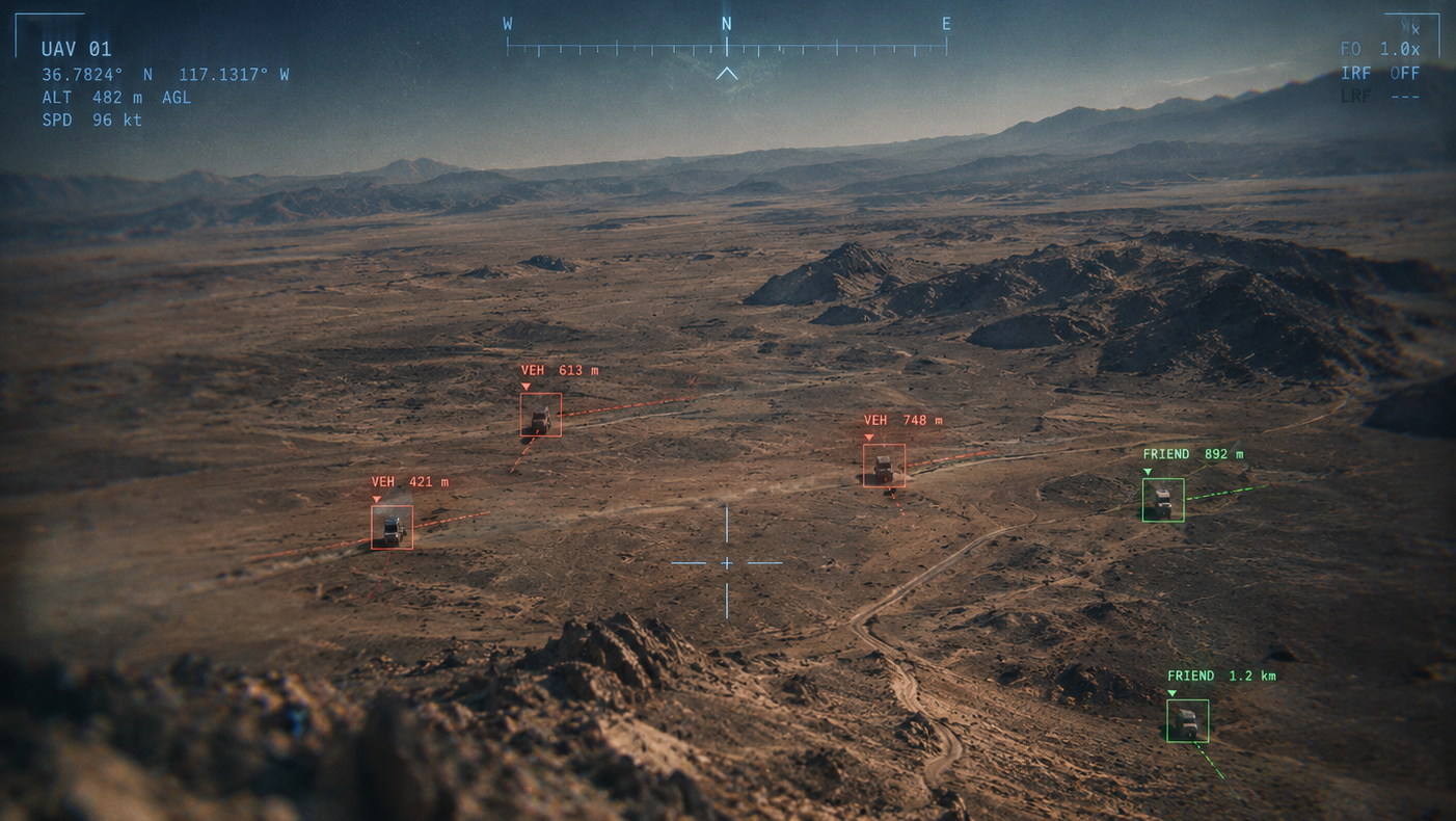
Autonomous Target Engagement closes flight guidance and control loops directly around real-time visual tracking errors during the terminal phase of a mission. The autopilot executes proportional navigation (PN) and line-of-sight rate guidance laws derived from camera measurements, commanding aerodynamic surfaces and thrust vectors to minimize the miss distance.

This capability is vital for loitering munitions, precision kinetic interception, and automated landing on moving platforms (such as ships or land vehicles), ensuring successful mission completion even when electronic warfare jammers completely deny satellite navigation and ground communications.

Inertial & Terrain-Based Navigation

Navigation computed onboard the Veronte flight control computer. Redundant inertial measurement units, air data, magnetometers, and terrain-referencing inputs are fused by the navigation filter to keep attitude, velocity, and position bounded when satellite signals are lost, while GNSS integrity monitoring detects jammed or spoofed solutions before they reach the control loops.

Core Inertial Navigation

Core Inertial Navigation

Inertial Navigation Systems (INS) provide autonomous dead-reckoning state estimation without external radio signals. Using a tactical-grade MEMS Inertial Measurement Unit (IMU) the system measures specific forces and angular rates in real time. The navigation processor integrates angular velocity using singularity-free quaternions for 3D attitude tracking, transforms body accelerations into the local NED frame, and compensates for gravity and Coriolis effects.

An Extended Kalman Filter (EKF) continuously estimates sensor biases and fuses inertial propagation with secondary aids: barometric altimetry and magnetometers stabilize altitude and heading, while optical flow or visual-inertial odometry constrains velocity drift. For prolonged operations, absolute position drift is bounded using map-matching or terrain relative navigation (TRN).

Terrain Relative Navigation (TRN)

Terrain Relative Navigation (TRN)

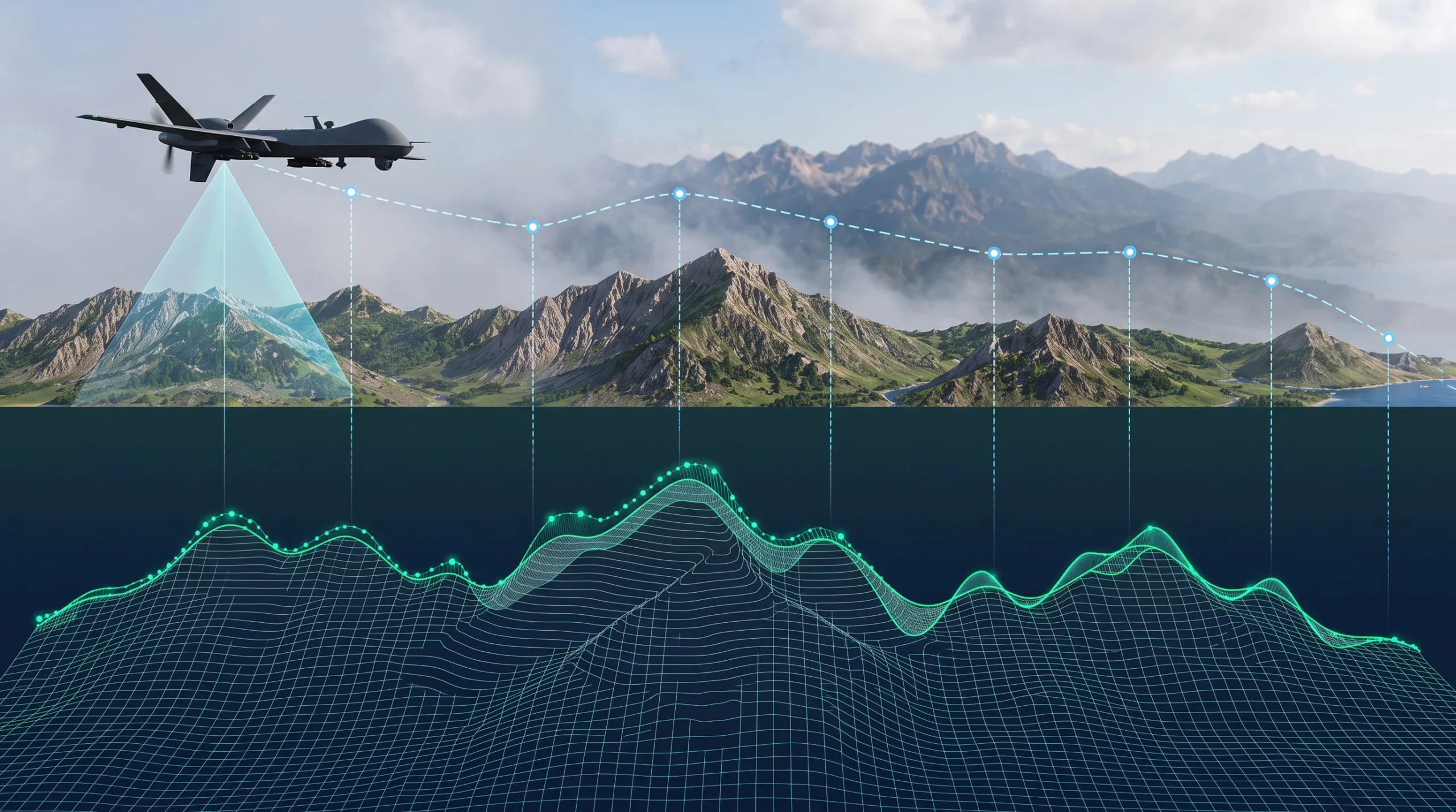
Terrain Relative Navigation (TRN) enables autonomous platforms to establish their position by correlating real-time terrain measurements with pre-loaded digital elevation models (DEM / DTED). TRN continuously samples the terrain below and matches observed topological profiles against stored geographical grids.

These correlation algorithms deliver an absolute position estimate without drift, eliminating cumulative inertial errors and ensuring dependable, continuous navigation in GNSS-denied or contested environments.

Visual Based Navigation

Passive, radio-silent camera-based navigation. Visual sensors observe the ground and the environment to provide independent position, velocity and guidance references that cannot be jammed or spoofed.

Map-Free Visual Navigation

Map-Free Visual Navigation

Map-Free Visual Navigation enables UAVs to operate autonomously in GNSS-denied environments without requiring pre-loaded maps, terrain models, or prior mission data. By using onboard sensors to track ground feature displacement in real time, the system creates continuous visual motion references regardless of unfamiliar terrain or complete satellite outages.

During flight, the system fuses live optical flow with internal inertial and altitude sensors in real time. These rapid calculations translate pixel motion into true metric ground velocity, allowing the UAV to eliminate short-term drift, maintain precision hovering, and execute agile maneuvers through unmapped corridors with zero RF emissions.

Map-Based Visual Navigation

Map-Based Visual Navigation

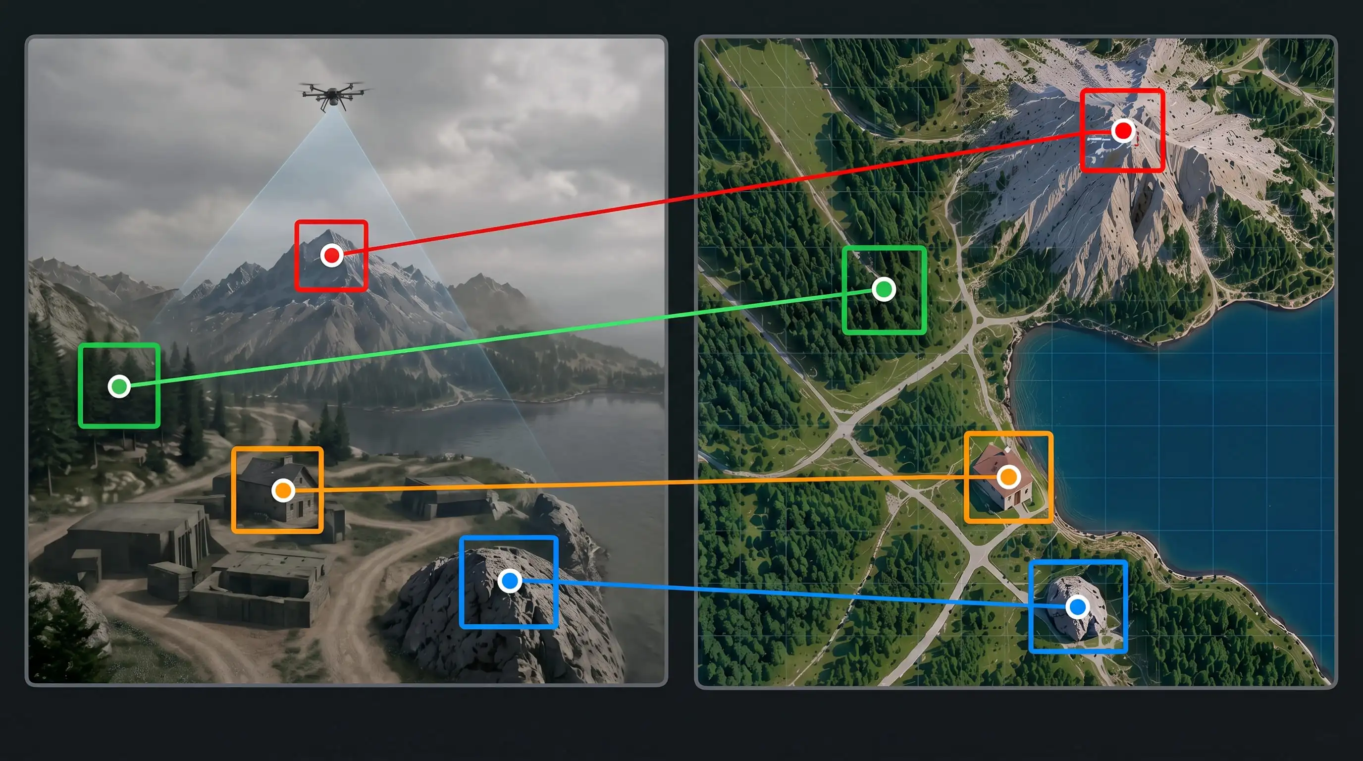
Map-Based Visual Navigation enables UAVs to execute long-range autonomous missions in contested airspace by matching live aerial camera imagery against pre-loaded, geo-referenced satellite orthomosaics. This establishes an unjammable global positioning reference without relying on external RF links or satellite signals.

As the aircraft traverses the flight corridor, the system identifies permanent ground features and calculates perspective-corrected transformations in real time. These continuous updates deliver drift-free absolute coordinates, allowing the UAV to maintain exact route accuracy and reach mission waypoints under total GNSS denial.

RF Positioning

Radio-frequency alternatives to satellite positioning: ranging through the datalink and ground beacons, resilient GNSS reception and signals of opportunity that keep the aircraft located over the operation area.

LEO Positioning

LEO Positioning

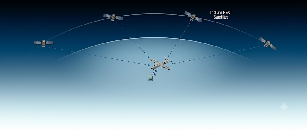
LEO Positioning leverages satellite constellations orbiting in Low Earth Orbit (500 to 1,500 km altitude) to provide jam-resistant positioning, navigation, and timing (PNT) as an alternative or backup to traditional GNSS. Because LEO satellites operate much closer to Earth than MEO constellations (~20,000 km), their signal power at the aircraft antenna is 20 to 30 dB higher, making them substantially harder to jam.

Additionally, LEO satellites travel at high orbital velocities with rapid geometry changes and pronounced Doppler shifts. The navigation receiver measures Doppler frequency variations and ranging signals to compute velocity vectors and position fixes independently of legacy GPS or Galileo systems.

  • Low Earth Orbit PNT
  • Alternative Satellite Navigation
4G/LTE PNT

4G/LTE PNT

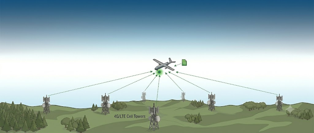
4G/LTE PNT provides an independent, terrestrial alternative positioning, navigation, and timing source that operates without any reliance on satellite constellations. Utilizing an onboard cellular transceiver connected to the flight control architecture, the system listens to ambient radio frequency emissions broadcast by commercial multi-tower telecommunication networks, identifying nearby base stations through unique cell IDs.

By measuring Time-Difference-of-Arrival (TDOA), Received Signal Strength (RSSI), and antenna phase Angle-of-Arrival (AOA) relative to known terrestrial tower coordinates, the navigation filter executes real-time hyperbolic triangulation. This yields a reliable horizontal position fix to bound inertial drift and maintain safe trajectory control throughout low-altitude corridors and urban canyons.

  • Cellular Network Positioning
  • Terrestrial Radio Ranging
  • Signals of Opportunity (SoOP) PNT